Lawrence Creek Wildlife Area – Wisconsin Public Land
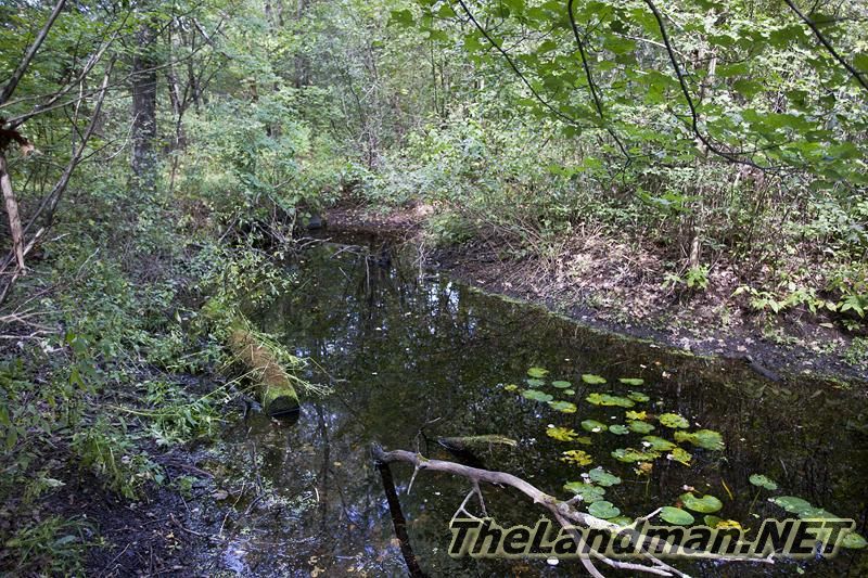
Lawrence Creek Wildlife Area is about 961 acres according to the Wisconsin Department of Natural Resources (WI DNR) this includes Lawrence Creek Fishery & State Natural Area. It’s located just west of Westfield WI 53964 in Lincoln Township of Adams County and Springfield / Westfield Township of Marquette County. Also known as Lawrence Creek Fishery Area which is considered public land open to hunting, fishing, hiking and more… Lawrence Creek trout stream headwaters are located at the western end and winds through the wildlife area about 2.7 miles flowing into Lawrence Lake at the eastern end of the fishery area. Lawrence Creek is classified as a class 1 trout stream great habitat for brook trout making good fishing trout waters for the area.
Parking Areas Info, Maps & Photos - Main Page | 1st Ave | 2nd Ave | 2nd Dr | Dyke Ct | Eagle Ave Creek | Eagle Ave Wetlands | Eagle Ave Lake Access
In general the creek is normally very clear with high visibility with a nice rolling terrain around the stream with some areas of wetlands and high banks.
Lawrence Lake | North Boat Launch | South Boat Launch | Dam | Lawrence Creek | Wildlife Area | State Natural Area
WI DNR LAND

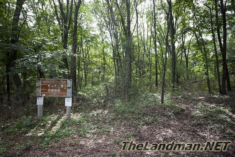
There are 6 main parking areas for Lawrence Creek Wildlife Area
Southwest Parking Lot is located at the corner of S. Eagle Ave & 2nd Ave
Parking Lot just South of Lawrence Creek on 1st Ave
Parking Area on Eagle Ave: 1st is about ¼ mile east of 1st Ave
2nd Parking Area on Eagle Ave is about ¾ east of 1st Ave.
Eastern Parking Lot off of 2nd Drive about ¼ mile north of Eagle Ave
Northeast Parking area on Dyke Court just west of 2nd Drive
Photos and Pictures


Allowed Activities
- Wildlife Viewing
- Hunting
- Trapping
- Fishing
- Cross Country Skiing (No Designated Trails)
- Hiking (No Designated Trails)
- Snowshoeing
- Foraging for Wild Edibles
- Birding
- Snowmobiling in DESIGNATED AREAS ONLY!
- Outdoor Education
- Scientific Research with a Permit (Contact WI DNR)
- Pets (Rules posted on Wisconsin Department of Natural Resources Website)
Activities NOT ALLOWED!
- Horseback Riding
- Camping
- Campfires
- Motor Vehicles including Bicycles
- Rock Climbing
- Collecting Non-Edibles
- Geocaching
Lawrence Creek Wildlife Area Map
Trout Stream Classifications
Class 1 which means “high quality trout waters with sufficient natural reproduction”
Class 2 - has some natural trout reproduction
Class 3 - Marginal trout habitat with NO natural trout reproduction with stocking required
Area Wisconsin Public Land
- Lawrence Creek State Natural Area
- Lawrence Creek Wildlife Area
- Statewide Habitat Areas
- Upper Fox Headwaters SNA
- New Chester Waterfowl Production Area
- Caves Creek Fishery Area
- John A Louton Fishery Area
- Mecan River Fishery Area
- Upper Neenah Creek State Fishery Area
Nearby WI Communities
- Westfield WI 53964
- Oxford WI 53952
- Coloma WI 54930
- Grand Marsh WI 53936
- Brooks Wisconsin
- Lawrence Wisconsin
- Harrisville Wisconsin
- Springfield Corners Wisconsin
- Montello Corners
Area Wisconsin Lakes
- Lawrence Lake
- East Twin Lake
- West Twin Lakes
- Rollers
- Echo
- Sandow
- Mud
- Fenner
- Westfield Pond
- Patrick Lake
- Pine Lake
- McGinnis Lake – Headwaters for Neenah Creek Trout Stream
- Swamp Lake
- Ogle
- Harrisville
Area Creeks & Trout Streams
- Lawrence Creek – Trout Stream – Class 1
- Westfield Creek
- Caves Creek – Trout Stream – Class 1
- Klawitter Creek
- Neenah Creek – Trout Stream – Classes 1 & 2
Lakefront Homes & Deeded Access Cabins for Sale
These homes are located in Lincoln Township of Adams County - Westfield Township & Springfield Township of Marquette County in the Lawrence Creek Area!
Waterfront Lots & Deeded Access Properties for Sale
These vacant land parcels are located in Lincoln Township of Adams County - Westfield Township & Springfield Township of Marquette County in the Lawrence Creek Area!
