Area Information Tabs
START with
NAME
END with
Adams County WI
- Townships
- Cities, Towns & Villages
- Lakes, Flowages & Named Ponds
- Creeks and Trout Streams
- Public Land, Parks, Boat Launches, Wildlife Area & Refuges
- Rock Formations
- Developments & Subdivisions
Juneau County WI
- Townships
- Cities, Towns & Villages
- Lakes, Flowages & Named Ponds
- Creeks and Trout Streams
- Public Land, Parks, Boat Launches, Wildlife Area & Refuges
- Rock Formations
- Developments & Subdivisions
Marquette County WI
- Townships
- Cities, Towns & Villages
- Lakes, Flowages & Named Ponds
- Creeks and Trout Streams
- Public Land, Parks, Boat Launches, Wildlife Area & Refuges
- Rock Formations
- Developments & Subdivisions
Waushara County WI
- Townships
- Cities, Towns & Villages
- Lakes, Flowages & Named Ponds
- Creeks and Trout Streams
- Public Land, Parks, Boat Launches, Wildlife Area & Refuges
- Rock Formations
- Developments & Subdivisions
Wood County WI
- Townships
- Cities, Towns & Villages
- Lakes, Flowages & Named Ponds
- Creeks and Trout Streams
- Public Land, Parks, Boat Launches, Wildlife Area & Refuges
- Rock Formations
- Developments & Subdivisions
Hotspots Mapping - Area Information
Mapping - https://thelandman.net/hotspot-maps.html
Rome WI
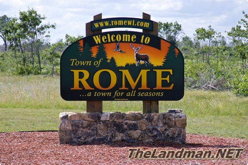
Rome Township is located at the northwest part of Adams County, Central Wisconsin home of the Tri-Lakes; Lake Arrowhead 300 acres, Lakes Sherwood 246 acres & Lake Camelot 445 acres. The areas around the lakes are heavily developed and have covenants, rules, regulations and restrictions. There are literally hundreds of deeded lake access parcels on both sides of Hwy 13 around these all sports fishing lakes. There are a couple of stream running through Rome including Chester Creek, Spring Branch which flows into Sherwood Lake, Fourteen Mile Creek which fills Lake Camelot and Lake Arrowhead then dumps in to Lake Petenwell that is part of the Wisconsin River Flowage System. Twin Lakes is also located in the Township right across the street from Petenwell right by Twin Lakes Nature Preserve; 45 wooded / wetland acres. There are two rock formations Hamilton Mound and D'oro Couche aka Dyracuse Mound part of Dyracuse Off-Road Park close to Monroe Prairie Recreation Area for ATVing. Most of the back roads are open to both ATVing and Snowmobiling via routes. Rome WI is known for the Lake Arrowhead Golf Courses; The Pine Course and The Lakes Course plus Room to Roam Dog Park.
Rome Township WI - https://thelandman.net/rome-township-wi.html
Tri-Lakes

Tri-Lakes WI is located in Rome Township, Adams County of Central Wisconsin south of Wisconsin Rapids. The Tri Lakes consist of Lake Arrowhead 350 acres of water and a max depth of 30 ft., Lake Camelot 445 acres of water, a max depth of 24 ft., 246 acres of water and a max depth of 27 ft. This area features Room to Roam Dog Park, Lake Arrowhead County Park, Shermalot Water Ski Show, The Pines Golf Course, The Lake Golf Course, Lake Camelot County Park, Fourteen Mile Creek, Spring Brook, Lake Sherwood County Park and more... Rome Township is loaded with ATV Routes, Snowmobile Trails and Public Lands!
Tri-Lakes WI - https://thelandman.net/tri-lakes-wi.html
Room To Roam Dog Park
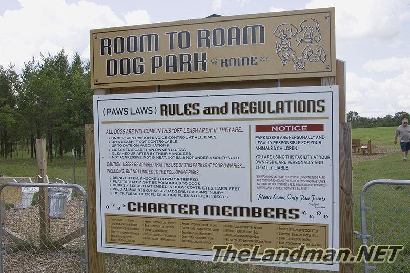
Room to Roam Dog Park is located in Rome Township, Adams County of Central Wisconsin by the Tri-Lakes; Lake Arrowhead, Camelot Lake & Lake Sherwood just west of Lake Petenwell and south of Wisconsin Rapids.
Not to far from Room to Roam Dog Park in Leola Township you can find Central Wisconsin Grassland Conservation Area which is a Dog Training Area.
Room To Roam Dog Park of Rome WI - https://thelandman.net/room-to-roam-dog-park.html
Lake Petenwell

Lake Petenwell is Wisconsin’s second largest body of water (23,000+ Acres), created by Wisconsin River Power Company in the 1940s by building a Hydroelectric Dam on the Wisconsin River. Lake Petenwell is also known as Petenwell flowage. It has plenty of fine waterfront real estate around Petenwell County Park which is one of Central Wisconsin’s most popular parks. Just south of the Petenwell Dam, is Castle Rock Lake, which is WI 4th largest lake. You can not boat from lake petenwell to castle rock lake. Theses two lakes, along with the Wisconsin, River separate Adams County & Juneau Cty. Today Lake Petenwell is one of Central Wisconsin biggest attractions along with Wisconsin Dells, which is only about 30 minutes directly south.
Lake Petenwell - https://Lake-Petenwell.com
Leola Marsh Wildlife
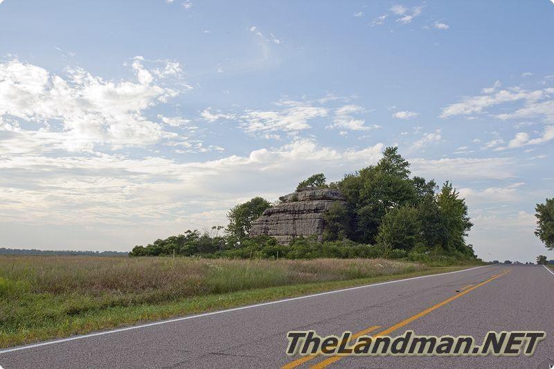
Leola Marsh Wildlife Area is located in Leola Township, Adams County of Central Wisconsin featuring Owens Rock which is a rock formation. LMWA has three location the main one at the is located at the intersection of County Road D & W, second location is just south on County Rd W and the third is located to the west at Apache Ave and 3rd Ave. Most of the area is accessible by road but there are two designated parking areas located on Cty WI and 3rd Ave. Leola Marsh Wildlife Area attracts hundreds if not thousands of Sand Hill Cranes every year. Big Roche-A-Cri Fishery Area is located just south and is also open to the public with Big Roche-A-Cri Creek class trout stream.
Leola Marsh Wildlife Area - https://thelandman.net/leola-marsh-wildlife-area.html
Central Wisconsin Grassland Conservation Area

The Central Wisconsin Grassland Conservation Area is 160 acres created by four 40 acre parcels located in Leola Township of Adams County, WI. It's located north of Alpine Ave, south of Akron Dr. and east of 5th Ave. There is a driveway off of Akron Dr. at 469 according to the Adams County GIS website. This area was purchased by the state from a private owner in 2008. In general it’s a pretty flat area of grasslands with a deeper trench with Fourteen Mile Creek cutting through the Conservation Area flowing from northeast to southwest. It appears to be an area for training bird dogs with signs posted “Dog Training Area”. Find plenty of wildlife in this area!
Central Wisconsin Grassland Conservation Area - https://thelandman.net/central-wisconsin-grassland-conservation-area.html
Big Roche-A-Cri Fishery Area

Big Roche-A-Cri Fishery Area is about 826 acres located in Leola Township of Adams County and Plainfield Township of Waushara County, Central Wisconsin. This public land area is spread out in about 6 sections / zones along the Big Roche-A-Cri Creek which is a “class 1” trout stream. Access points are limited because most of the land around the fishery area is surrounded by privately owned parcels. The roads touching Big Roche-A-Cri Fishery Area are Cty G, Cty KK, Archer Dr., 4th Ave and Aspen Ave. Most of the access is roadside parking and there are 3 parking lots located on Archer Dr. & 4th Ave. According to the Wisconsin Department of Natural Resources, fishing, hunting, trapping, hiking, birding, photography are allowed including having pets. Brook trout are the predominant trout species in this section of the creek, but you can find some brown trout as well. There are a wide variety of wildlife in the fishery including; whitetail deer, beaver, eastern wild turkey, grouse, wood chucks, squirrels. You can find red oaks, white oaks, red pine, white pines, jack pines, birch trees even some row pines in the sandy low land soils.
Big Roche-A-Cri Fishery Area - https://thelandman.net/big-roche-a-cri-fishery-area.html
Adams County

Adams County is Located in Central Wisconsin between Wisconsin Rapids and Wisconsin Dells consisting of 17 Townships featuring fishing lakes, trout streams, lots of public land, ATV routes, Snowmobile Trails and rock formations. This county is known for 3 types of industries; recreation tourism, farming (mostly corporate) and small businesses. State Highway 21 is the main artery for East & West and State Hwy 13 is the main artery for North & South travel.
Adams County WI - https://thelandman.net/adams-county-wi.html
Leola WI
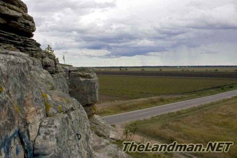
Leola Township is located in Adams County, Central Wisconsin most North Eastern township and mostly consists of farm land owned by a small number of people plus there are a couple of large parcels of State Land open to the public. There are no lakes and only 2 creeks in Leola, Big Roche-A-Cri Creek which flows Big Roche-A-Cri State Fishery and Fourteen Mile Creek which flows through Central Wisconsin Grassland Conservation Area then helps fill all three of the Tri-Lakes; Lake Camelot, Lake Sherwood & Lake Arrowhead in Rome Township to the west. Leola Township is home to Owens Rock which is located in Leola Marsh Wildlife Area.
Leola Township WI - https://thelandman.net/leola-township-wi.html
Lakeland Forest Development

Lakeland Forest is located in Rome Township of Adams County, Central Wisconsin along Lake Camelot on 9th Ave. This development is on the east side of the Tri-Lakes which is one of subdivisions with the largest lots in the area. The area is filled with public land, ATV routes, Snowmobile trails, boat launches plus access to several lakes including Lake Petenwell, Twin Lakes, Tri-Lakes; Arrowhead, Camelot and Sherwood.
This location is just in just minutes from Lake Camelot County Park quick is open to the public which has a boat launch. Lake Camelot County Park is on Lake Camelot BUT is also on Lake Sherwood as well. These lakes are filled with Walleye, Panfish, Bass, Northern Pike and more...
Lakeland Forest WI Development - https://thelandman.net/lakeland-forest-wi.html
Lake Camelot
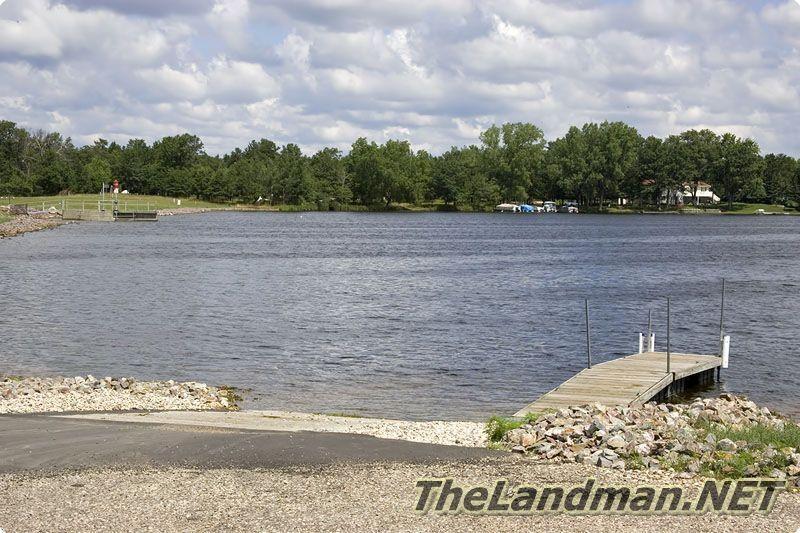
Lake Camelot is located in Rome Township of Adams County, Central Wisconsin and is the largest of the Tri-lakes with a sand bottom, about 445 acres of water, a max depth of 24 ft. and an average depth of 9 ft. Fourteen Mile Creek flows into the lake on the east end, continuous to where Lake Camelot & Lake Sherwood meet on the west end where the dam is located then turn back into the creek and into Lake Arrowhead a short distance down. Spend a day at Lake Camelot County Park located on the south end near the middle of the lake.
The county park is call Lake Camelot County Park, it’s located on the western shoreline close to where the dam flows the water into Lake Sherwood and then back into Fourteen Mile creek. Camelot Lake has a nice variety of fish including Walleye, Largemouth Bass, Northern Pike and Panfish also check out the Wisconsin Wildlife around The Tri-Lakes. Not too far down stream is Wisconsin’s 2nd largest body of water; Lake Petenwell.
Camelot Lake - https://thelandman.net/lake-camelot-wi.html
Lake Sherwood

Lake Sherwood is located in Rome Township of Adams County, Central Wisconsin also known as Deer Lodge Lake because the Tri-Lakes Deer Lodge. Sherwood is the smallest of the Tri-lakes with about 246 acres of water and a max depth of 27 ft. and an average depth of 10 ft. It's fed by Spring Brook which flows into the lake from the northeast. You would think that Lake Sherwood would be the home of Shermalot Waterski show but that is on Lake Arrowhead.
The county park is call Lake Sherwood County Park, it’s located on the western shoreline close to where the dam flows the water into into Fourteen Mile Creek then into Lake Arrowhead. Sherwood has a nice variety of fish including Walleye, Largemouth Bass, Northern Pike and Panfish also check out the Wisconsin Wildlife around The Tri-Lakes. Not too far down stream is Wisconsin’s 2nd largest body of water; Lake Petenwell.
Sherwood Lake - https://thelandman.net/lake-sherwood-wi.html
Arrowhead Lake

Lake Arrowhead is located in Rome Township of Adams County, Central Wisconsin it's also known as Manchester Lake (according to the official Wisconsin Lake Book by WI Department of Natural Resource) It is the second largest of the Tri-lakes with about 350 acres of water and a max depth of 30 ft. The Tri-lakes are all heavily subdivided and have covenants and some areas have association fees Lake Arrowhead is probably best known for it’s golf course, Lake Arrowhead County Park and Shermalot Water Ski Show. The Lake Arrowhead Golf Course consists of 2 courses; the original, “The Pines Course” & “The Lake Course” which has more water hazards. Both of these golf courses are 18 holes and have been recognized by Golf Digest as 2 of the better courses in the country including a 4.5 star rating on The Pines Course.
The county park is call Lake Arrowhead County Park, it’s located on the western shoreline close to where the dam flows the water back into Fourteen Mile Creek. Arrowhead Lake has a nice variety of fish including Walleye, Largemouth Bass, Northern Pike and Panfish also check out the Wisconsin Wildlife around The Tri-Lakes. Not too far down stream is Wisconsin’s 2nd largest body of water; Lake Petenwell.
Arrowhead Lake - https://thelandman.net/lake-arrowhead-wi.html
Wildlife Refuge

Necedah National Wildlife Refuge is located in Necedah Township, Kingston Township, Cutler Township, and Finley Township of Juneau County just west of Necedah, WI. 54646. The refuge is a little under 70 square miles of wildlife habitat with 6 Trails, several named bodies of water including: Goose Pool, Sprague Pool, Harvey Pond, Suk Flowage, Cerney Flowage, Mather Flowage, Yellow River, Rynearson Flowage and more… Hiking, Hunting and Fishing is allowed in certain areas, certain times of the year so check with the Necedah Wildlife Visitors Center located on Headquarters Road. Not too far from the wildlife area is WI’s 2nd & 4th largest inland bodies of water Lake Petenwell and Castle Rock Lake both part of the Wisconsin River Flowage System.
Necedah National Wildlife Refuge - https://thelandman.net/necedah-wildlife-refuge.html
Lake Petenwell
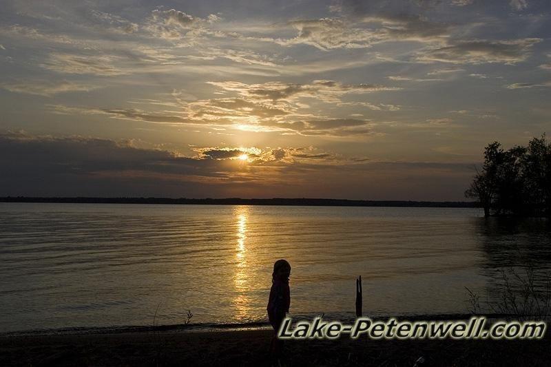
Lake Petenwell is Wisconsin’s second largest body of water (23,000+ Acres), created by Wisconsin River Power Company in the 1940s by building a Hydroelectric Dam on the Wisconsin River. Lake Petenwell is also known as Petenwell flowage. It has plenty of fine waterfront real estate around Petenwell County Park which is one of Central Wisconsin’s most popular parks. Just south of the Petenwell Dam, is Castle Rock Lake, which is WI 4th largest lake. You can not boat from lake petenwell to castle rock lake. Theses two lakes, along with the Wisconsin, River separate Adams County & Juneau Cty. Today Lake Petenwell is one of Central Wisconsin biggest attractions along with Wisconsin Dells, which is only about 30 minutes directly south.
Lake Petenwell - https://Lake-Petenwell.com
Castle Rock Lake

Castle Rock Lake was manmade and built back in the late 1940’s by Wisconsin River and Power Company by constructing a hydro-electric dam called the Castle Rock Dam. With an impoundment of 13,000+ acres of water, it is Wisconsin’s 4th largest body of water. Castle Rock Lake is one of Central WI. most popular attractions and has been for many years. Today it is used for boating, fishing and swimming with something going on nearly all the time.
Castle Rock Lake is part of the Wisconsin River Flowage System which includes Lake Petenwell (WI’s 2nd Largest) to the north. From the Petenwell Dam, there is a little stretch of Wisconsin river before it opens up into Castle Rock lake. After Castle Rock Dam the water turns back into the Wisconsin river and flows all the way to the Wisconsin Dells dam. “You CANNOT boat from Lake Petenwell to Castle Rock Lake to the Wisconsin River because to the hydroelectric dams.”
Castle Rock Lake - https://Castle-Rock-Lake.com
Buckhorn State Park
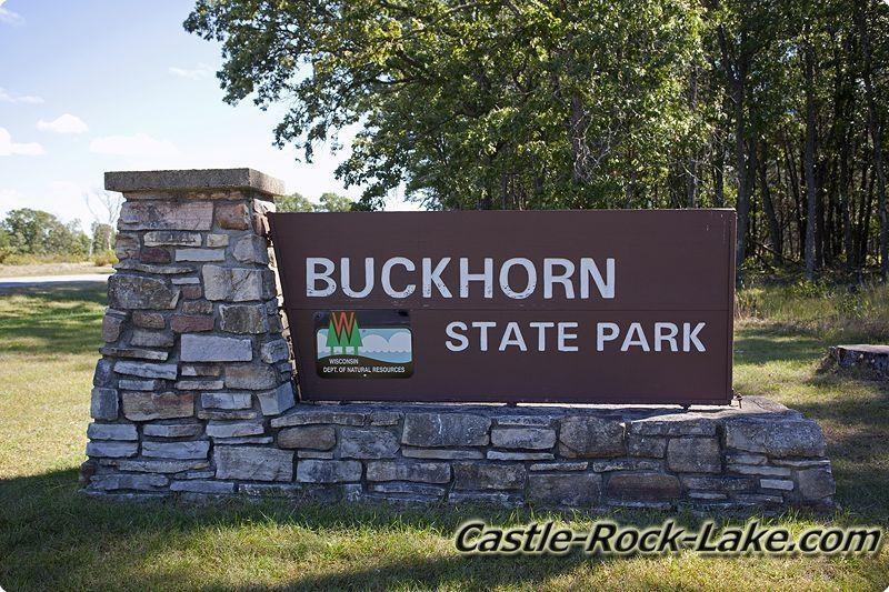
Buckhorn State Park is located in Germantown Township of Juneau County, Central Wisconsin on both Castle Rock Lake and the Yellow River. The park consists of about 6,000 acres of outdoor haven offering a little bit for everyone including the local Wisconsin Wildlife. There’s lot of outdoor photography opportunities and nature experiences to have if its camping, hiking, canoeing, kayaking, hunting, trapping, boating, swimming, fishing, backpacking, picnicking or just sitting back and watching the natural world go by. The state park includes miles of frontage and several boat launches offering tons of water activities on the Yellow River and Castle Rock Lake part of the Wisconsin Flowage system. Castle Rock is WI’s 4th largest inland body of water and is a manmade lake controlled by a hydro dam (creating hydroelectricity) to the South where the water turns back into the Wisconsin River.
Buckhorn State Park - https://thelandman.net/buckhorn-state-park-wi.html
Juneau County

Juneau County, WI is located between Adams-Friendship and Tomah in central part of the state along the Wisconsin River flowage system which creates both Lake Petenwell and Castle Rock Lake. Juneau is known for farming, hilly terrain, public land, ATV trails, hunting, fishing, rock formations, public land which also has Necedah Wildlife Refuge, Buckhorn State Park, Hardwood Air-to-Ground Gunnery and Bombing Range plus a couple communities including; Necedah, New Miner, New Lisbon, Mauston and Elroy. It's surrounded by 7 other Counties; Wood, Adams, Columbia, Sauk, Vernon, Monroe and Jackson. On this page you'll find links for more detail information including tourism, things to do, places to go, visitor information, sporting events, lakes, rustic roads, farmers markets, parks, camping, fishing, hunting, snowmobiling, ATVing, outdoor recreation and more…
Juneau County WI - https://thelandman.net/juneau-county-wi.html
Cutler Township

Cutler Township is located in Juneau County, Central Wisconsin just East of Monroe County, North of Camp Douglas and West from the Village of Necedah. This township is between Wyeville and Necedah where the Union Pacific railroad connects the two small towns. This area is mostly wooded with lots of wetlands. There is a lot of land open to the public via Central Wisconsin Conservation Area, Meadow Valley State Wildlife Area, Necedah National Wildlife Area and Juneau County public lands. You can find some water to fish in many places including: Eagle’s Nest Flowage, Little Yellow River, Lemonweir River, several creeks and named and unnamed ditches. State Highway 21 runs East and West through the whole Town of Cutler. Other main roads include County Road M & H. Most but not all of Juneau County Roads are now open to ATVing, so check local regulations. ATV Maps
Buffalo Lake WI
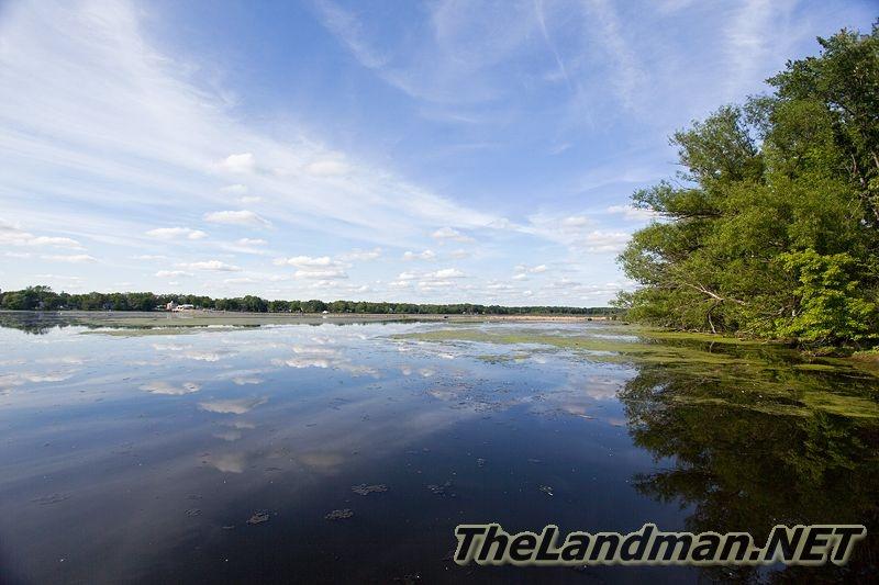
Buffalo Lake is located mostly in Packwaukee Township but Montello and West Buffalo Townships as well in Marquette County of Central Wisconsin by Endeavor, Packwaukee, Montello WI. The lake is about 2179 acres with a max depth of 8 feet with mostly a muck bottom with some sand. This is a flowage of the Fox River Green Bay Tributary which flows northeast which is very rare; only about 3 dozen river flow north in the world. There's are four boat launches one by the Montello Dam on the east end of the lake, another on north side in middle of the on County Road C, the boat ramp on the south side by Packwaukee on County Road D and the final boat landing by Endeavor at the very south end. Buffalo Lake is more like a wide river then a typical lake; it's about 10+ miles long but only about 1/3 of a mile wide.
Buffalo Lake WI - https://thelandman.net/buffalo-lake-wisconsin.html
Packwaukee South Boat Launch - https://thelandman.net/buffalo-lake-wisconsin-town-of-packwaukee-south-boat-landing.html
Cty C North Boat Landing - https://thelandman.net/buffalo-lake-wisconsin-county-c-boat-landing.html
Page Creek Marsh State Natural Area
Page Creek Marsh State Natural Area is located in Marquette County just south of Buffalo Lake on County Road K. Page Creek flows into Buffalo Lake which is a flowage of the Fox River Green Bay Tributary, one of the rare rivers that flows north. This large wetland preserve is home to waterfowl, rare meadow birds and lots of diverse Wisconsin plant life plus is also home to Bright Lake, Mud Lake and Pollys Lake. This area is part of the Central Sands at the very southeast edge right were the terrain starts rolling. Page Creek Marsh is owned by The Nature Conservancy but is open to the Public. It consists of wetlands, remnant prairies and oak savanna which is home to a wide variety of Wisconsin Wildlife including waterfowl, Whitetail Deer, Wild Turkey, Raccoons, Sandhill Cranes, Mallard Ducks, Wood Ducks, Geese, Herons, Beaver, Red Fox, Native Birds, Frogs, Turtles, Snakes and more.
Page Creek Marsh SNA - VIDEO - https://thelandman.net/page-creek-marsh-state-natural-area.html
North Trail - https://thelandman.net/page-creek-marsh-north-trail.html
Page Creek South Trail - https://thelandman.net/page-creek-marsh-south-trail.html
Page Creek WI
Page Creek is about 4 miles long starting at Gale Ave in Marquette County, Central Wisconsin and ending into Buffalo Lake which is the Fox River – Green Bay Tributary. Page Creek is NOT a class trout stream according to WI DNR.
Page Creek - https://thelandman.net/page-creek-wi.html
Fox River
The Green Bay Tributary of the Fox River is 200+ miles long ENDS in Lake Michigan in the City of Green Bay then flows southwest through Kaukanna WI, Appleton WI, Menasha WI, Neenah WI into Lake Winnegabo (Wisconsin's Largest Inland Lake). Then continues northwest into Lake Butte Des Morts and exits flowing again southwest to Waushara County for only about a 3 to 4 mile stretch going through the City of Berlin. This is where the Fox River get's much smaller still flowing southwest to Princeton WI, then flows into Pukaway Lake then flows northwest to into Buffalo Lake the turns south down to Portage WI. From the Portage area the river turns to the east through Swan Lake and Park Lake where the Fox River Headwaters are found in a swampy area by the Columbia County and Green Lake County Border.
Fox River - https://thelandman.net/fox-river-wisconsin.html
Willow Creek Fishery Area
Willow Creek Fishery Area in Waushara County WI is open to the public for hunting and fishing it consists of MULTIPLE LOCATIONS streching about 10 miles from Wild Rose to Redgranite with Willow Creek, Cedar Spring Creeks, Rattlesnake Creek, Thornstead aka Bruce Creek flowing through it which are class trout streams. The fishery area is so long it goes through 6 of Waushara County Townships including; Warren, Rose, Mount Morris, Leon, Marion and Spring Water. According to the WI DNR there's about 2,200+/- acres in the Willow Creek Fishery Area which is open to lot of recreational activities including Hunting, Trout Fishing, Foraging and more...
Willow Creek Fishery Area - https://thelandman.net/willow-creek-fishery-area.html
Pearl Lake
Pearl Lake is located in Leon Township, Waushara County, Central Wisconsin by Redgranite WI which is about 101 acres with a max depth of 45 feet with mostly a sand bottom and considered one of Central Wisconsin's CLEAREST LAKES. There's a boat launch on the south side of the lake with a parking area across the road. Pearl Lake is located just north of State Highway 21 by Redgranite between Willow Creek and Middle Lake.
Pearl Lake - https://thelandman.net/pearl-lake-wisconsin.html
Redgranite WI
Redgranite WI 54970 is located in Waushara County, Central Wisconsin in 3 different townships mainly in Warren Township but also Leon Township and Marion Township. This area features Redgranite Quarry Lake, Willow Creek Fishery Areas, Pearl Lake, Willow Creek Park, Lake Alpine, Public Land, Trout Streams, Public Hunting Grounds, Lite Shopping, Restaurants, Alpine County Park, Bannerman Snowmobile / Hiking Trails and much more… The general area is mostly wooded with some wetlands and agriculture farming cropland with trout waters winding through the country side. The Village of Redgranite is a smaller community with a population a little over 2,100 and it's known for the Correctional Institution.
Redgranite WI - https://thelandman.net/redgranite-wi-54970.html
Warren Township WI
Warren Township is located in Waushara County, Central Wisconsin home to the towns of Lohrville and Redgranite. This area has a lot of wetlands with drainage ditches, unnamed creeks, Willow Creek trout stream flowing through it with Willow Creek Fishery Area which is open to the public for hunting and fishing. Part of Mill Pond is in the township which is fed by Willow Creek. There are two manmade lakes: Redgranite Quarry and Lohrville Quarry both within the city/village limits; there is one more body of water called Jordans Lake which is privately owned. Because of the wetter soils most of the land parcels are larger hunting acreages known for Whitetail Deer, Wild Turkey, Waterfowl and lots of small game. There are no Boat Landings in Warrens Township. The main artery for this area is State Highway 21 but there are some County Roads including F, E, N and EE.
Warren Township WI - https://thelandman.net/warren-township-wi.html
Waushara County
Waushara County, WI is located between Adams and Waupaca in the central part of the state along Lake Poygan. Waushara is known for its farming, Amish communities, boating, fishing, hunting, biking, hiking, arts, culture, golfing, rolling terrain, spring fed lakes, parks, public lake, wildlife, bird watching, snowmobiling, skiing, ice skating which also has Plainfield Tunnel Channel Lakes State Natural Area, Ice Age Trail, Greenwood State Wildlife Refuge, Mecan Springs, State Natural Area, Upper Fox Headwaters State Natural Area, Lunch Creek Wetlands State Natural Area, Silver Lake, Irogami Lake, Mecan River plus a couple communities including; Plainfield, Coloma, Richford, Spring Lake, Redgranite, Wild Rose, Saxeville, Poy Sippi and Wautoma. It's surrounded by 6 other Counties; Portage, Waupaca, Winnebago, Green Lake, Marquette and Adams. On this page you'll find links for more detail information including tourism, things to do, places to go, visitor information, sporting events, lakes, rustic roads, farmers markets, parks, camping, fishing, hunting, snowmobiling, ATVing, outdoor recreation and more… Waushara County has 18 Townships.
Waushara County WI - https://thelandman.net/waushara-county-wi.html
Fox River
The Green Bay Tributary of the Fox River is 200+ miles long ENDS in Lake Michigan in the City of Green Bay then flows southwest through Kaukanna WI, Appleton WI, Menasha WI, Neenah WI into Lake Winnegabo (Wisconsin's Largest Inland Lake). Then continues northwest into Lake Butte Des Morts and exits flowing again southwest to Waushara County for only about a 3 to 4 mile stretch going through the City of Berlin. This is where the Fox River get's much smaller still flowing southwest to Princeton WI, then flows into Pukaway Lake then flows northwest to into Buffalo Lake the turns south down to Portage WI. From the Portage area the river turns to the east through Swan Lake and Park Lake where the Fox River Headwaters are found in a swampy area by the Columbia County and Green Lake County Border.
Fox River - https://thelandman.net/fox-river-wisconsin.html
Berlin WI
City Berlin WI 54923 is located in Waushara County, in Aurora Township and Green Lake County in Berlin Township, Central Wisconsin. This area features Fox River, Serveral Town Parks, River Side Park, Mascouin Golf Club, Berlin Fen State Natural Area, Public Land, Trout Streams, Public Hunting Grounds, Shopping, Restaurants, Schools, Willow Creek Fishery Area, White River Marsh Wildlife Area, REM Fox River Eureka Locks, Koro Railroad Priarie SNA and much more… The general area is mostly farmland with wetlands and some woods with the Fox River winding through the country side. The City of Berlin is a midsize community with a population a little over 5,500 and it's home to the school district and a branch of Girl Scouts of America.
Berlin WI - https://thelandman.net/berlin-wi-54923.html
Aurora Township WI
Aurora Township is located in Waushara County, Central Wisconsin with the smaller north part of Berlin in it and the southern larger part in Green Lake County. Most of this area is large acreages except for properties around Fox River and Mill Pond. There are a lot of wetlands and drainage ditches cutting through the country side. Besides the park / boat launch at Mill Pond there isn’t much for public land in this area. On the east side of the pond is a small town called Auroraville. There is how ever a good side intersection formed by State Highway 21 & 49 with some commercial properties on the corners. In this area you’ll find lots of lowlands, farmlands with some scatted batches of woods.
Aurora Township WI - https://thelandman.net/aurora-township-wi.html
Willow Creek Fishery Area
Willow Creek Fishery Area in Waushara County WI is open to the public for hunting and fishing it consists of MULTIPLE LOCATIONS streching about 10 miles from Wild Rose to Redgranite with Willow Creek, Cedar Spring Creeks, Rattlesnake Creek, Thornstead aka Bruce Creek flowing through it which are class trout streams. The fishery area is so long it goes through 6 of Waushara County Townships including; Warren, Rose, Mount Morris, Leon, Marion and Spring Water. According to the WI DNR there's about 2,200+/- acres in the Willow Creek Fishery Area which is open to lot of recreational activities including Hunting, Trout Fishing, Foraging and more...
Willow Creek Fishery Area - https://thelandman.net/willow-creek-fishery-area.html
Waushara County
Waushara County, WI is located between Adams and Waupaca in the central part of the state along Lake Poygan. Waushara is known for its farming, Amish communities, boating, fishing, hunting, biking, hiking, arts, culture, golfing, rolling terrain, spring fed lakes, parks, public lake, wildlife, bird watching, snowmobiling, skiing, ice skating which also has Plainfield Tunnel Channel Lakes State Natural Area, Ice Age Trail, Greenwood State Wildlife Refuge, Mecan Springs, State Natural Area, Upper Fox Headwaters State Natural Area, Lunch Creek Wetlands State Natural Area, Silver Lake, Irogami Lake, Mecan River plus a couple communities including; Plainfield, Coloma, Richford, Spring Lake, Redgranite, Wild Rose, Saxeville, Poy Sippi and Wautoma. It's surrounded by 6 other Counties; Portage, Waupaca, Winnebago, Green Lake, Marquette and Adams. On this page you'll find links for more detail information including tourism, things to do, places to go, visitor information, sporting events, lakes, rustic roads, farmers markets, parks, camping, fishing, hunting, snowmobiling, ATVing, outdoor recreation and more… Waushara County has 18 Townships.
Waushara County WI - https://thelandman.net/waushara-county-wi.html
Marquette County
Marquette County, WI is located between Wisconsin Dells and Redgranite in the central part with the Fox River which is one of the rare rivers that flows northwest. Marquette is known for its farming, Amish communities, boating, fishing, hunting, biking, hiking, arts, culture, golfing, rolling terrain, spring fed lakes, parks, public lake, wildlife, bird watching, snowmobiling, skiing, ice skating which also has Caves Creek Fishery, Lawrence Creek Wildlife Area, Germania Wildlife Area, Mecan River Fishery Areas, Upper Fox River Public Access, White River Marsh Wildlife Area, Buffalo Lake, Germania Marsh, Lawrence Lake, Montello Lake, Oxford Lake, Puckaway Lake, Silver Lake, Neenah Lake, Caves Creek Trout Stream, Chaffee Creek, Fox River, Mecan River, O'Keefe Creek, Wedde Creek, White Creek plus a couple communities including; Briggsville, Endeavor, Germania, Harrisville, Montello, Neshkoro, Oxford, Packwaukee and Westfield. It's surrounded by 4 other Counties; Adams, Waushara, Green Lake and Columbia. On this page you'll find links for more detail information including tourism, things to do, places to go, visitor information, sporting events, lakes, rustic roads, farmers markets, parks, camping, fishing, hunting, snowmobiling, ATVing, outdoor recreation and more… Marquette County has 13 Townships.
Marquette County WI - https://thelandman.net/marquette-county-wi.html
Marquette County
Marquette County, WI is located between Wautoma and Portage in the center part of the state with the Fox River flowing through it. Marquette is known for its fishing, hunting, public land, snowmobiling, hiking, biking, boating, wildlife watching, parks, golfing, camping, oaks, pines, trout streams which also has Lawrence Creek State Fish Wildlife Area, Summerton Bog State Natural Area, John Muir Memorial County Park, Lawrence Lake, Buffalo Lake plus a couple communities including; Westfield, Briggsville, Endeavor, Oxford, Packwaukee and Montello. It's surrounded by 4 other Counties; Waushara, Green Lake, Columbia and Adams.
Marquette County WI - https://thelandman.net/marquette-county-wi.html
Lawrence Lake
Lawrence Lake also known as Lawrence Pond is located in Westfield Township of Marquette County, Central Wisconsin. The lake is fed by Lawrence Creek trout stream on the Northwest side which helps fill it then is formed by a dam on the eastside which turns into Westfield Creek that flows into the village of Westfield that also creates Westfield Pond. Lawrence Lake is known typically as a fishing lake that is mostly surrounded by privately owned vacant land parcels and residential homes. There is a large piece of public land on the northwest side of the lake around Lawrence Creek stream known as Lawrence Creek State Natural Area & Lawrence Creek Wildlife Areas which is open to Hunting, Hiking, Fishing, Wildlife Viewing, Cross Country Skiing and more…
Lawrence Lake - https://thelandman.net/lawrence-lake.html
Lawrence Creek Class Trout Stream
Lawrence Creek class trout stream starts in Lincoln Township, Adams County then flows into Springfield Township and then Westfield Township of Marquette County in Central Wisconsin. It’s very short; only about 2.5 miles long of excellent brook trout habitat with is surrounded by both Lawrence Creek State Natural Area and Lawrence Creek Wildlife Area before it flows into Lawrence Lake. Lawrence Creek trout stream is class 1 fishing waters for Brook Trout.
The eastern portion of Lawrence Creek SNA is the headwaters location for Lawrence Creek trout stream which is class 1 brook trout waters. The creek is normally very clear with high visibility with a nice rolling terrain around the stream with some areas of wetlands and high banks.
Lawrence Creek Class Trout Stream - https://thelandman.net/lawrence-creek-trout-stream.html
Lawrence Creek Wildife Area
Lawrence Creek Wildlife Area is about 961 acres according to the Wisconsin Department of Natural Resources (WI DNR) this includes Lawrence Creek Fishery & State Natural Area. It’s located just west of Westfield WI 53964 in Lincoln Township of Adams County and Springfield / Westfield Township of Marquette County. Also known as Lawrence Creek Fishery Area which is considered public land open to hunting, fishing, hiking and more… Lawrence Creek trout stream headwaters are located at the western end and winds through the wildlife area about 2.7 miles flowing into Lawrence Lake at the eastern end of the fishery area. Lawrence Creek is classified as a class 1 trout stream great habitat for brook trout making good fishing trout waters for the area.
Lawrence Creek Wildlife Area - https://thelandman.net/lawrence-creek-wildlife-area.html
Lawrence Creek State Natural Area
Lawrence Creek State Natural Area is located within Lawrence Creek Wildlife Area the SNA consists of 2 areas one in Lincoln Township of Adams County on the east side of 1st Ave and one in Springfield Township & Westfield Township of Marquette County on the west side of 1st Ave. The eastern portion of Lawrence Creek SNA is the headwaters location for Lawrence Creek trout stream which is class 1 brook trout waters.
In general the creek is normally very clear with high visibility with a nice rolling terrain around the stream with some areas of wetlands and high banks.
Lawrence Creek State Natural Area - https://thelandman.net/lawrence-creek-state-natural-area.html



 And then Add to Home Screen.